Europe After World War II
 
Frameworks for America's Past
Return to
Originating Page


Many areas of Europe were in ruins after WW II

The photo below shows Berlin, the capital of Germany, immediately after
World War II ended.  Many other parts of Germany, plus large areas of
Russia and some other countries were also in ruins after the war. 


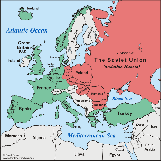
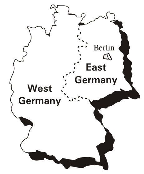
Germany was split in two


   Germany was partitioned (divided) soon after World War II ended into two separate parts: West Germany and East Germany.

   At the end of World War II, the western part of Germany was occupied and controlled for a few years by U.S., British, and French forces.  As soon as it was ready, West Germany was set up as an independent, democratic nation with its own government.

   The eastern part of Germany was occupied by the Soviet Union at the end of the war.  It remained under their control when Germany was officially divided.  The Soviet Union never allowed East Germany to form an independent or democratic government. 
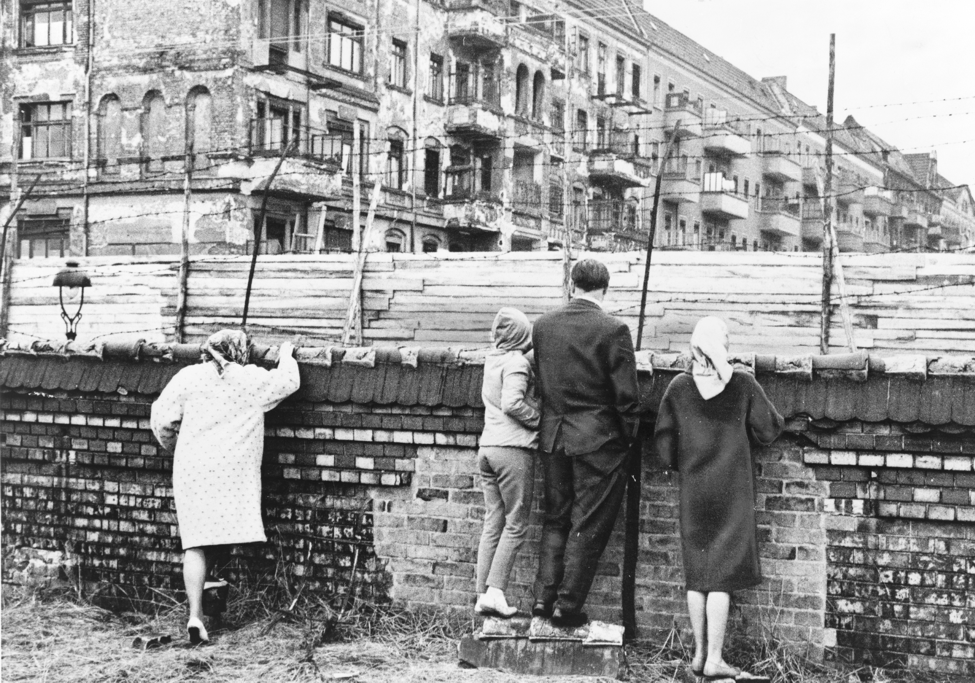
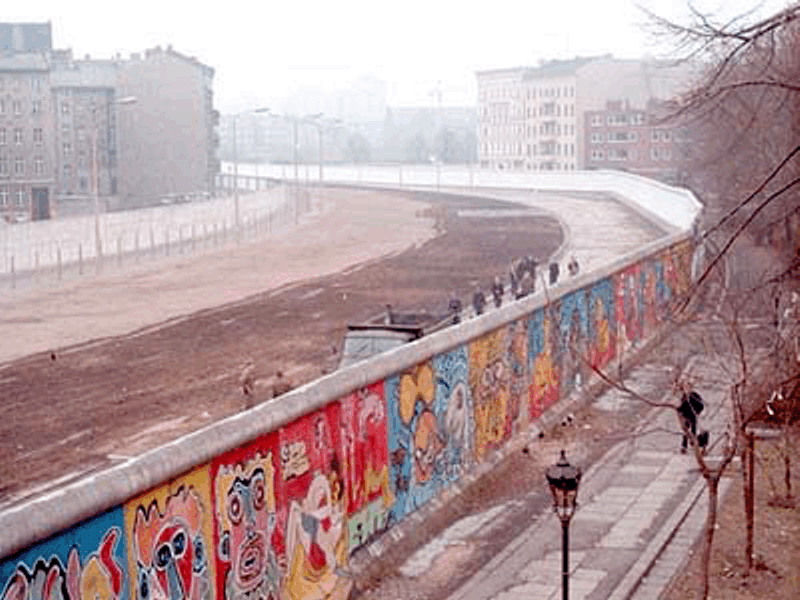
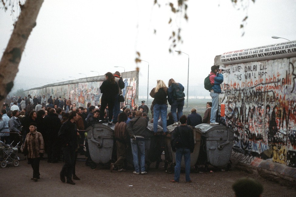

   Berlin, the capital of Germany, was itself divided into West Berlin (controlled by West Germany) and East Berlin (controlled by East Germany.)


Rebuilding Europe: the Marshall Plan

The U.S. government gave $13 billion in money, food, and equipment to countries in Europe
to help them rebuild after World War II.  This program of help was called the Marshall Plan,
named after a military leader from Virginia who helped develop and win support for the idea.
 
The Marshall plan was part of the U.S. policy of containment - the effort to keep
communism from spreading.  U.S. leaders hoped that if the countries of Europe
got back on their feet quickly, with a stable economy and a stable government,
their citizens would not be tempted to adopt the system of communism.

Below left:  A poster urges the people of Europe to stick together and
stay friends with the U.S. in the years after World War II. 
Below right:  George C. Marshall, a military leader from Virginia who
pushed for the plan to help rebuild Europe after the war.


Europe divided: NATO and the Warsaw Pact

The map below shows the way Europe was divided into two "camps" or groups by
the mid-1950s.  Nations that became military allies with the United States in the
North Atlantic Treaty Organization (NATO) are shown in green. 
The nations that became military allies with the Soviet Union in
the Warsaw Pact are shown in red.  (A pact is an agreement.)


The Berlin Wall was built by East Germany

In 1961 East Germany built a solid fence across the city of Berlin.  Communist
leaders of East Germany wanted to stop people from East Berlin (the
communist side) who wanted to escape to West Berlin (the free side). 
This fence became known as the Berlin Wall.

The photo below shows people are in West Berlin, looking across
the barrier into East Berlin.


East German soldiers would shoot anyone attempting to cross the wall. 
The wall was rebuilt over time with tall sections of concrete, shown below.
The Berlin Wall became a very visible symbol of the tension and divisions
of the Cold War era. 


The Berlin Wall was torn down in 1989 as people across Europe began
openly defying communist leaders.  The photo below shows a spot
where crowds began to break down the concrete sections of the wall.

East Germany abandoned the communist system, and Germany was reunited in 1990.


In 1991, communism collapsed in the Soviet Union and the Soviet Union
ceased to exist as a country.  The 15 states that made up the former Soviet Union
(including the largest, Russia) all became separate, independent countries.
 
The countries shown in color in this 1994 map, plus Lithuania, Latvia, and Estonia,
were once states of the former Soviet Union.


The George C. Marshall photo is from the Library of Congress.
The color photo of the Berlin Wall and the poster image are courtesy Wikipedia.
The photo of the Berlin Wall being torn down is from the U.S.
Department of Defense.
All maps except the Commonwealth of Independent States map are by David Burns.
The Commonwealth of Independent States map is a U.S. C.I.A. map from 1994,
and is in the public domain.
Some images have been edited or resized for this page.


Copyright Notice

   Copyright 2011, 2016 by David Burns.  All rights reserved.  As a guide to the Virginia Standards of Learning, some pages necessarily include phrases or sentences from that document, which is available online from the Virginia Department of Education.  The author's copyright extends to the original text and graphics, unique design and layout, and related material.